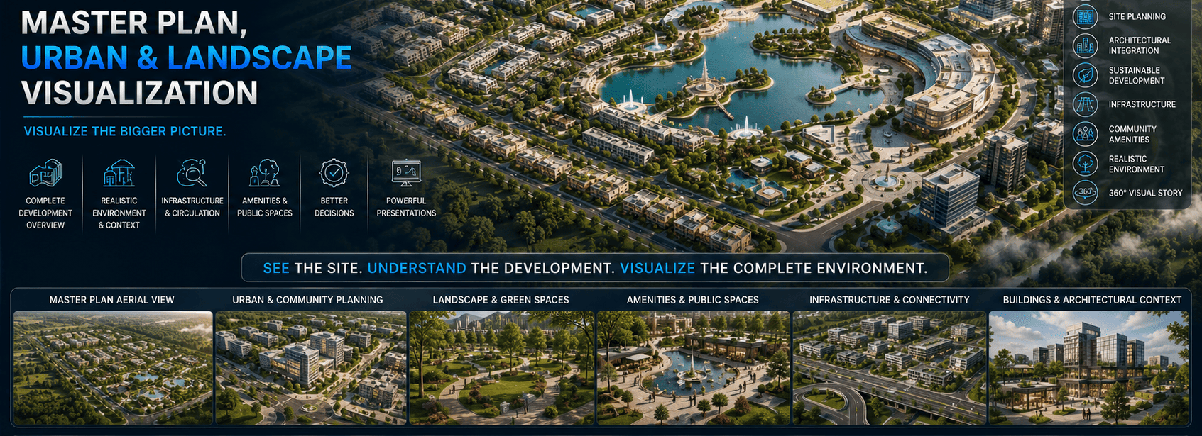
01What is Master Plan Visualization?
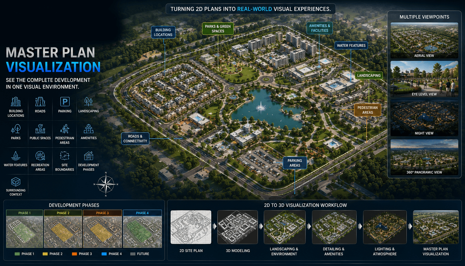
See the Complete Development in One Visual Environment.
Master plan visualization converts 2D site plans, planning drawings, CAD data or design concepts into a detailed 3D representation of a proposed development.
A master plan can communicate:
Instead of viewing the project as lines and symbols on a plan, stakeholders can understand the development as a complete three-dimensional environment.
Building locationsRoadsParkingLandscapingParksPublic spacesPedestrian areasAmenitiesWater featuresRecreation areasSite boundariesDevelopment phasesSurrounding context
023D Master Plan Visualization
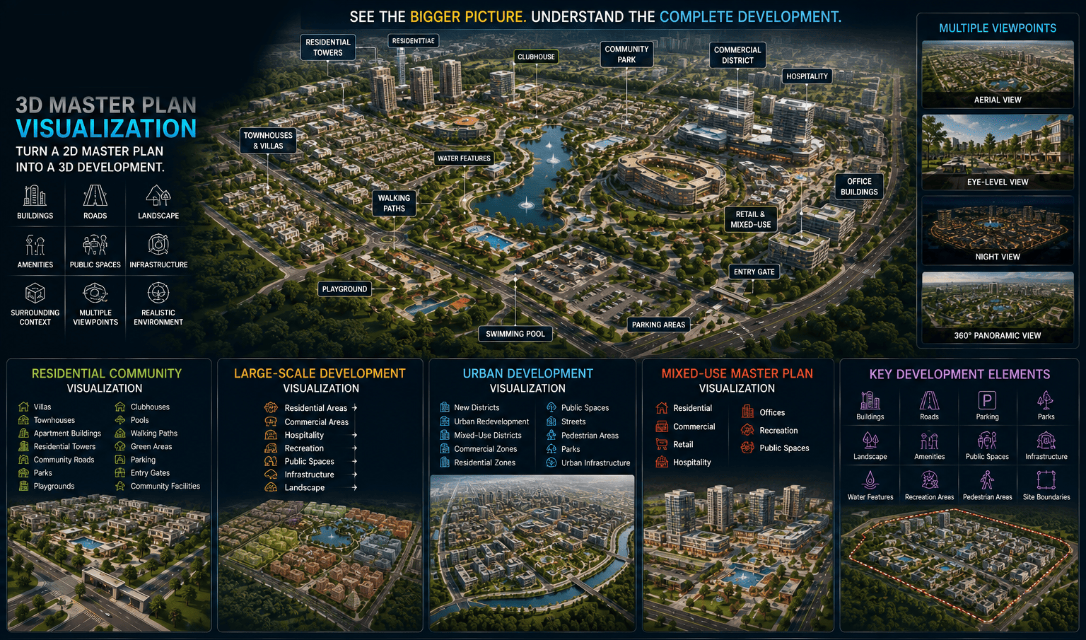
Turn a 2D Master Plan Into a 3D Development.
We can transform available planning information into visual representations showing:
The final visualization can be presented through aerial views, eye-level perspectives or other agreed viewpoints.
BuildingsRoadsLandscapeAmenitiesPublic SpacesInfrastructureSurrounding Context
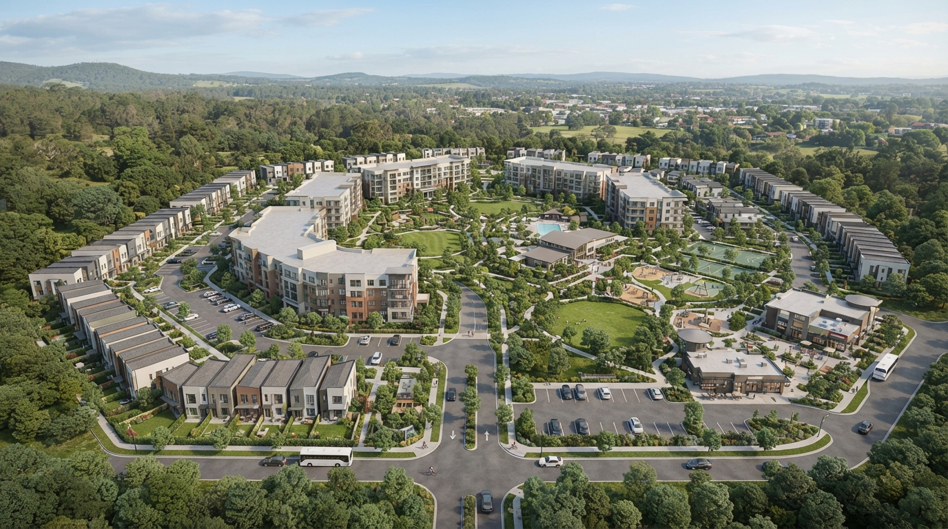
03Residential Community Visualization
Show the Complete Community Before It Is Built.
For housing developments and residential communities, visualization can include:
This helps developers and architects communicate the relationship between individual properties and the overall community.
VillasTownhousesApartment buildingsResidential towersCommunity roadsParksPlaygroundsClubhousesPoolsWalking pathsGreen areasParkingEntry gatesCommunity facilities
04Large-scale Development Visualization
Visualize Complex Developments as One Connected Environment.
Large developments can contain multiple zones and building types.
We can visualize relationships between:
This creates a unified visual representation of the proposed development.
Residential AreasCommercial AreasHospitalityRecreationPublic SpacesInfrastructureLandscape
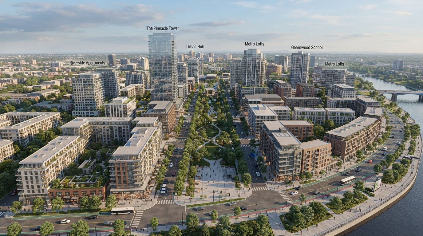
05Urban Development Visualization
Visualize Cities, Districts & Urban Environments.
Urban visualization can represent larger-scale development concepts including:
The objective is to help stakeholders understand the spatial relationship between different elements of the proposed environment.
New districtsUrban redevelopmentMixed-use districtsCommercial zonesResidential zonesPublic spacesStreetsPedestrian areasParksUrban infrastructure
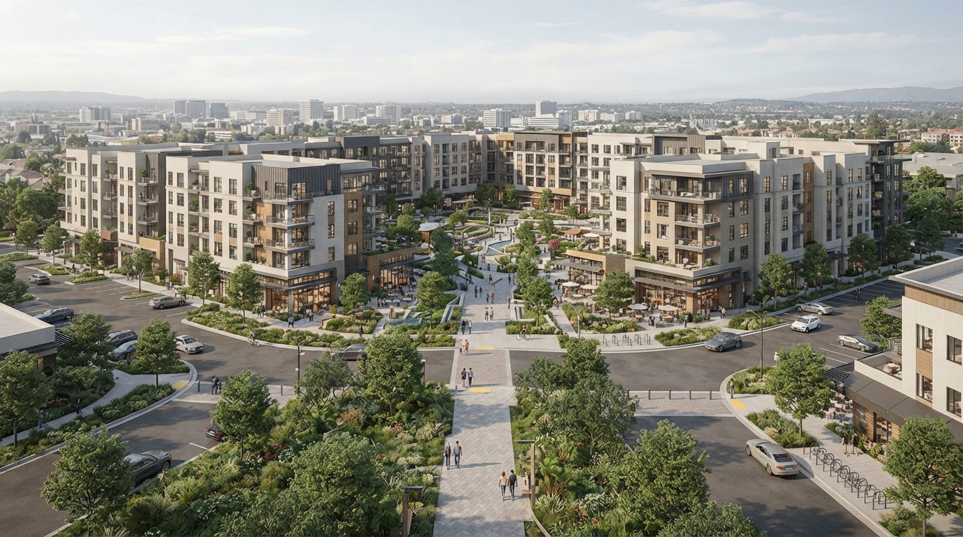
06Mixed-use Master Plan Visualization
Bring Multiple Functions Together.
Mixed-use developments can combine:
A 3D master plan can show how these components interact within the overall site.
ResidentialCommercialRetailHospitalityOfficesRecreationPublic spaces
07Landscape Visualization
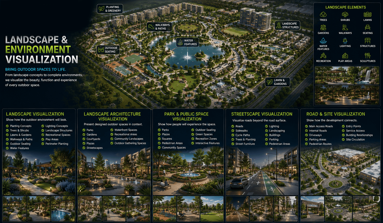
Show How the Outdoor Environment Will Look.
Landscape visualization can communicate:
The visualization is developed from supplied landscape or design information and approved references.
Planting conceptsTreesShrubsLawnsGardensWalkwaysOutdoor seatingWater featuresLighting conceptsLandscape structuresRecreational spaces
08Landscape Architecture Visualization
Present Designed Outdoor Spaces in Context.
Landscape architecture visualization can help communicate:
The surrounding architecture can be included where necessary to establish context.
ParksGardensCourtyardsPlazasStreetscapesWaterfront spacesRecreational areasCommunity landscapesOutdoor gathering spaces
09Park & Public Space Visualization
Show How People Will Experience the Space.
Public-space visualization can include:
People, furniture and environmental elements can be incorporated where appropriate to communicate the intended experience.
ParksPlazasSquaresPedestrian areasCommunity gathering spacesOutdoor seatingGreen spacesRecreational zones
10Streetscape Visualization
Visualize Roads Beyond the Road Surface.
A streetscape can include:
This creates a more complete understanding of how a proposed street environment may look.
RoadsSidewalksCycle pathsTreesStreet furnitureLightingLandscapingBuildingsParkingPedestrian areas
11Road & Site Visualization
Show How the Development Connects.
Site visualization can communicate:
This is particularly useful for larger developments where circulation is an important part of the project.
Main access roadsInternal roadsDrivewaysParkingPedestrian routesEntry pointsService accessBuilding relationships
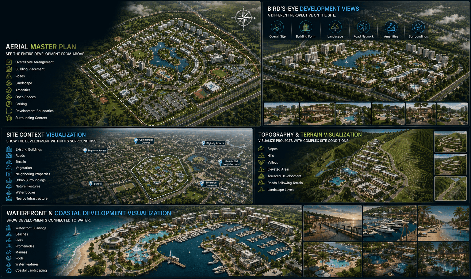
12Aerial Master Plan Visualization
See the Entire Development From Above.
Aerial visualization provides a high-level view of the development.
It can communicate:
Aerial views can be created as clean planning visuals or more detailed marketing-oriented scenes depending on the intended use.
Overall site arrangementBuilding placementRoadsLandscapeAmenitiesOpen spacesParkingDevelopment boundariesSurrounding context
13Bird's-eye Development Views
A Different Perspective on the Site.
Bird's-eye views provide a more angled perspective than a conventional top-down master plan.
They can show:
This can be particularly effective for development presentations and marketing.
Overall SiteBuilding FormLandscapeRoad NetworkAmenitiesSurroundings
14Site Context Visualization
Show the Development Within Its Surroundings.
A proposed project rarely exists in isolation.
Context visualization can include:
This helps viewers understand the project's relationship with the surrounding environment.
Existing buildingsRoadsTerrainVegetationNeighboring propertiesUrban surroundingsNatural featuresWater bodiesNearby infrastructure
15Topography & Terrain Visualization
Visualize Projects With Complex Site Conditions.
For projects involving significant terrain, visualization can represent the supplied site information through:
The accuracy of terrain representation depends on the quality and completeness of the supplied site/topographic information.
SlopesHillsValleysElevated areasTerraced developmentRoads following terrainLandscape levels
16Waterfront & Coastal Development Visualization
Show Developments Connected to Water.
Where applicable, visualization can include:
This can be particularly useful for resorts, residential developments and mixed-use waterfront projects.
Waterfront buildingsBeachesPiersPromenadesMarinasPoolsWater featuresCoastal landscaping
17Resort Master Plan Visualization
Present the Complete Hospitality Environment.
A resort master plan may include:
Aerial and ground-level views can be combined to communicate both the overall resort and its individual experiences.
Hotel buildingsVillasPoolsRestaurantsSpa facilitiesGardensRecreation areasPathsBeachesWater featuresParkingService areas
18Campus & Institutional Visualization
Visualize Schools, Universities & Large Campuses.
Campus visualization can communicate:
This can help present proposed campus developments or expansions.
Academic buildingsStudent facilitiesSports areasRoadsParkingLandscapingPedestrian routesPublic spacesRecreational facilities
19Commercial & Business Park Visualization
Show How Commercial Buildings Work Together.
Business parks and commercial developments can be visualized with:
Office buildingsParkingRoadsLandscapingPedestrian zonesShared amenitiesPublic spacesEntry areas
20Industrial Site Master Plan Visualization
Visualize Industrial Sites at Development Scale.
For industrial developments, visualization can show:
This complements our Industrial & Product Visualization and Industrial Process Visualization services while focusing specifically on the site and development environment.
Factory buildingsWarehousesProduction facilitiesRoadsLoading areasParkingService accessLandscapingStorage areasSupporting infrastructure